Fish and chips: a very British obsession

Last Friday, 4 September, was National Fish and Chips Day. Which, in my view, is a bit odd. After all, the combination of fried fish and chipped potatoes is – unofficially, at least – the UK’s national dish, an iconic part of our cultural heritage. Although they won’t win many Michelin stars, fish and chips are a British staple, a British obsession even. Surely, every day is Fish and Chips Day?

Of course, the people who declared 4 September to be National Fish and Chips Day had an agenda. The festivities were the brainchild of NEODA. Never heard of them? Neither had I, but a quick trawl on the internet reveals NEODA to be the National Edible Oil Distributors Association, a trade organisation representing “all the major refiners, key packers and distributors of edible oils.” So now you know…I expect you feel much better for that!

It’s easy to understand why the good folk at NEODA want to promote fish and chips, but frankly they’re pushing against an open door. The British love affair with the dish has been around for at least 150 years, and shows no sign of abating.

We need to talk about chips

Q: When are chips not chips? A: When they’re (French) fries.

To assist North American readers of this post, I need to explain that the food item we Brits call “chips” is referred to on your side of the Pond as “fries,” or maybe “French fries.” The snacks that you describe as “potato chips” are called “potato crisps” over here, because…well, because they’re made from potatoes and are kinda crisp. Confusing, eh? When George Bernard Shaw, the renowned early 20th century Irish playwright, observed that “England and America are two countries separated by a common language,” this was exactly the sort of nonsense he had in mind.

We Brits like to think of chips as quintessentially British. Wrong! Of course it was an Englishman, Sir Walter Raleigh, who first introduced potatoes – originating in South America – to northern Europe in the late 16th century. However it was the French who invented chips, pieces of potato around 1cm square, cut in varying lengths and deep-fried. The clue’s in the appellation French fries, although the Belgians claim it was they – and not their southern neighbours – who made the culinary breakthrough

By the beginning of the 19th century chips had made it across the English Channel and were being cooked and eaten in the UK. First published in 1817, William Kitchiner’s cookbook The Cook’s Oracle, includes the earliest known recipe for something similar to modern chips. However, fish and chips, the double-act that was to wow the nation, had yet to make an appearance

A marriage made in heaven

As an island nation, we Brits have always eaten a lot of fish. However, coating fish in a floury batter and then frying it in oil was unknown until the early 1800s. The practice appears to have been brought to Britain by Jewish immigrants from Spain and Portugal, where fish was traditionally cooked in this fashion. It soon caught on, and is mentioned in Charles Dickens’s 1839 novel Oliver Twist, which references a “fried fish warehouse.”

Frankie’s Fish and Chips, the UK’s most northerly chippy, sells fish ‘n” chips to eat in or take away. We ate in, and had an excellent meal!

The marriage between the feisty fish and the humble chip was consummated around 20 years after Oliver Twist was first published. Who should get the credit is hotly disputed, just another chapter in the interminable tussle for cultural supremacy between “the south” (aka London and its environs) and “the north” (aka anywhere up-country of Watford.)

Proponents of southern supremacy claim the first combined fish and chip shop was opened by a Jewish immigrant, Joseph Malin, in east London around 1860. However, northerners have their own hero, one John Lees, who is believed to have been selling fish and chips out of a wooden hut at Mossley market, near Manchester in industrial Lancashire, in 1863.

Regardless of who thought of it first, fish ‘n’ chips soon became a staple food item, particularly amongst the working class poor, for whom the meal constituted a welcome addition to normally bland diets. Shops selling fish and chips for customers to take away and eat elsewhere, often wrapped in old newspaper for extra convenience and cheapness, became known as chippies. They quickly spread across the length and breadth of the country, serving urban populations that grew rapidly as the Industrial Revolution took hold.

But the passion for fish ‘n’ chips was not confined to densely populated industrial settings. The craze spread to small country towns, and isolated rural settings too. Last year we had the pleasure of visiting Frankie’s, the UK’s most northerly chippy. Situated in the village of Brae on the main island of Shetland, which lies almost around 200 miles off the north-east coast of Scotland, Frankie’s maintains a reputation for high quality fish ‘n’ chips despite its very remote location.

The red spot (top right of inset map) shows location of Frankie’s!

By 1930 there were more than 35,000 chippies across the UK. Today, there are still 10,500, serving an estimated 382 million meals of fish ‘n’ chips every year. This is equivalent to six servings annually for every British man, woman and child. Almost a quarter of the UK population is believed to visit a chippy at least once a week.

With the arrival of chippies in towns and cities across the UK, the lives – and diets – of working people would never be quite the same again. These days, of course, they face stiff competition from other fast-food outlets, including those selling burgers, fried chicken, and Indian and Chinese takeaways. All have their place, and some may even outsell their older rival, but none is so deeply embedded in British culinary culture as good ol’ fish ‘n’ chips!

Choose your fish

The most popular fish sold in chippies is cod (around 62%), followed by haddock (around 25%). Others, seen less frequently, include hake, skate, plaice, sole and pollock. Several years ago George’s, our local chippy, briefly offered hoki, a fish found in the waters around New Zealand. They don’t sell hoki any more, which is probably no bad thing considering the monstrous carbon footprint each portion entailed.
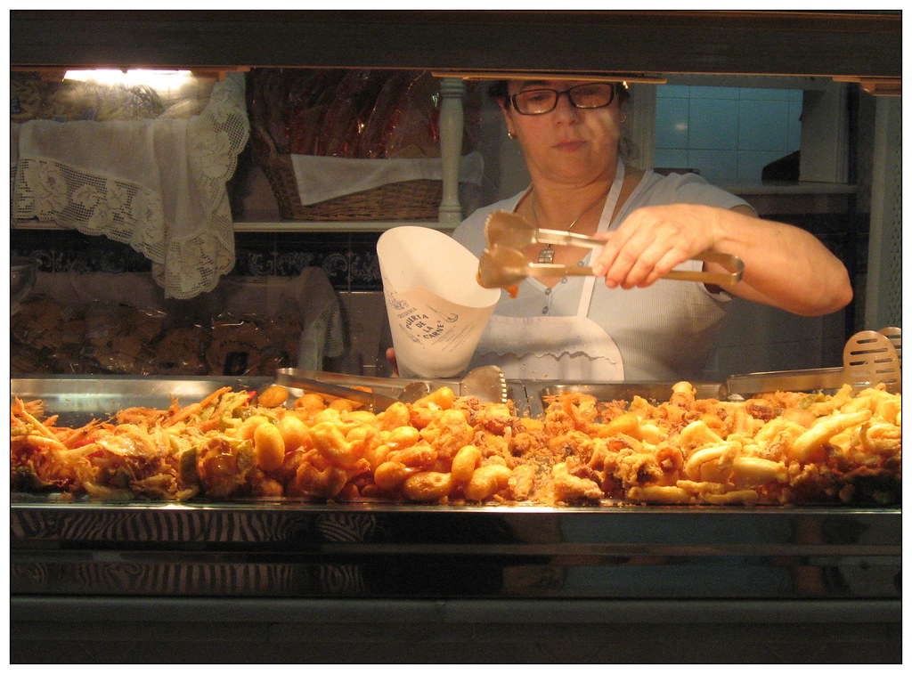
Growing up in London in the 1960s, my fish of choice was rock salmon. Sounds grand, doesn’t it? But the name is marketing bullshit, an attempt by canny fishmongers to glamorise the patently unglamorous dogfish, or huss. I now live in the English midlands, and up here they don’t sell rock salmon. I don’t know whether to be impressed that the locals have seen through the promotional smokescreen, or appalled that they are denying me a much-loved childhood treat.

Condiments and accompaniments

Originally a meal of fish ‘n’ chips was served with no condiment or accompaniment other than a sprinkling of salt, but today just about anything goes. While the standard condiment remains salt and vinegar, popular alternatives include curry sauce and gravy. Tomato ketchup is also well liked by some, and was favoured by none other than John Lennon. In Edinburgh, however, a tangy brown sauce is preferred.

Moving on to accompaniments or side dishes, pickles of various types, including onions, gherkins and eggs, all have their fans. And then, of course, there are mushy peas.

What in god’s name, I hear you ask, are mushy peas? Well, put it this way. Imagine dissolving Shrek, the Incredible Hulk, Kermit the Frog and a sack full of oversized, bullet-hard marrowfat peas in a seething vat of acid, and mixing the resultant pulp with a bucket-load of fermented goose droppings. Got the picture? Well, mushy peas are worse than that. They are the devil’s work.

Mushy peas

PHOTO CREDIT: “Mushy peas” by Simon Lieschke is licensed under CC BY-NC 2.0

Found mostly in more northerly parts of the country, mushy peas are an acquired taste that this Londoner-by-birth could never be bothered to acquire. It seems to me that anyone liking them must be just a little bit odd…on which point I should add that Michael Jackson is reputed to have adored mushy peas. I rest my case.

And while we’re exploring the darkest recesses of culinary good taste, perhaps I should mention the Deep Fried Mars Bar. In the UK Mars is a divinely decadent chocolate bar consisting of nougat and caramel covered in milk chocolate (the US version is rather different). “Naughty but nice” sums it up perfectly. In 1995 a Scottish chippy, encouraged by a pair of customers who were clearly chancing their luck, experimented with coating a Mars Bar in batter and then deep frying it.

The trial was pronounced a success (nobody died!) and pretty soon Deep Fried Mars Bars were on sale in chippies throughout Scotland, although whether anyone actually eats them alongside fish ‘n’ chips is unclear. I confess I’ve never tried one myself: life’s too short, and mine would probably be a damned sight shorter if I indulged in stuff like that.

Celebrating National Fish and Chips Day

It would have been churlish of us not to celebrate National Fish and Chips Day, so Mrs P did the decent thing and went online early Friday morning to place an order. I drove into town at lunchtime to collect the heavenly treat, and minutes later we were tucking into a feast of cod and chips, delicately seasoned with a sprinkling of salt and a splash of vinegar.

And not a mushy pea or deep fried Mars Bar in sight!

Isle of Man highlights – (5) The magic roundabout

Well, not magic really, but definitely quirky. The roundabout on the children’s playground at the Isle of Man’s Silverdale Glen is powered by water flowing from the nearby boating lake. Shifting the lever releases water which drives a waterwheel, which in turn powers the carousel. The roundabout is the only working example of its kind in the British Isles.

Silverdale Glen was developed as a visitor attraction in the last years of the 19th century. The site included a boating lake, café and a park for games and walking as well as roundabouts, and is a legacy of the Isle of Man’s growth as a tourist destination.

The waterwheel that drives the carousel originally came from the nearby lead / silver / zinc mines at Foxdale. When the mines were closed in 1911 the wheel was transported to Silverdale and reinstalled near the lake to provide the power needed to drive the ride-on horses. The link below will take you to my short YouTube video of the roundabout in action.

The roundabout has undergone numerous renovations in the century since it began operations. In 2007 the wooden horses – which were acquired second-hand from a steam-driven funfair in England – were removed and replaced with fibreglass gallopers and rowboats. One of the originals has been restored and deposited at the excellent Manx Museum. You can view the catalogue image here.

Postscript – while researching the history of Silverdale Glen’s magic roundabout I came across this fascinating post by WordPress blogger Pat English. Written way back in 2010, when we were younger, more innocent and had never heard of Coronavirus, Pat’s post explores the history of roundabouts. It includes lots of colourful carousel horse designs, one inspired by Siouxsie and the Banshees. Definitely worth a look.

Isle of Man highlights – (4) The Manx National Glens

Environmentalists are big fans of national parks, areas of land protected by governments for their beautiful countryside, rich wildlife and cultural heritage. All civilised countries have them, wearing them like badges of honour to demonstrate their commitment to conservation.

The word “park” conjures up the idea of great size, implying huge tracts of land stretching as far as the eye can see. But the Isle of Man is tiny, less than a quarter of the area of the Lake District, England’s foremost national park. A Manx national park is out of the question, but not to be outdone the island’s government has opted for National Glens instead.

A glen is a narrow valley, the word being derived from the Gaelic language, and there’s no doubt the glens are amongst the Isle of Man’s best natural features. They are heavily wooded, featuring rushing streams, tumbling waterfalls, fizzing cascades, deep rock pools and lush vegetation. Scattered here and there along them are the remains of watermills, echoes of a bygone age.

I don’t think you’d describe the National Glens as spectacular – the scale is wrong, too small – but definitely attractive and serene. They’re a perfect getaway from the hurly-burly of 21st century living.

The Manx government has designated no fewer than 18 mountain and coastal National Glens. These are preserved and maintained in a semi-natural state by its Forestry, Amenity and Lands Division, and are freely accessible to locals and tourists alike.

Pocket-sized though they are, the National Glens are a real asset to a little island in the middle of the Irish Sea. These compact and picturesque gems give the Isle of Man an unexpected but distinctive charm. Small really is beautiful.

In my book, few things in the natural world beat the sight and sound of running water amid the myriad greens of a secluded, verdant valley. Take a look at my YouTube video for a sense of the peaceful atmosphere in Silverdale Glen, Glen Maye, Ballaglass Glen and Glen Dhoon:

Isle of Man highlights – (2) Wallabies gone walkabout!

One of the unexpected pleasures of a visit to the Isle of Man is the opportunity to see wild wallabies without all the expensive and tedious nonsense that is inevitable when flying from the UK to Australia. Native to temperate areas of eastern Australia, the Red-necked Wallaby – a.k.a. the Bennett’s Wallaby – was a familiar sight when we visited Tasmania in 2016. Amazingly, it’s also thriving on Mann, a small island in the middle of the Irish Sea between England and Ireland, around 15,000 km from its ancestral home.

Technically, the Manx wallabies aren’t wild but feral, being descended from captive animals which escaped from Curragh Wildlife Park on the north of Mann towards the end of the last century. The first escape happened in 1965:

“The first wallaby to escape from there was Wanda who escaped the first year the park opened. She wandered around the island for a year, true to her name, and returned apparently of her own accord a year later,”

Paige Havlin, quoted in Lucy Quaggin: Living In The Wild On The Isle Of Man, Huffington Post (Australian edition) 07/03/2017.

A pair of wallabies is reported to have escaped at some point in the 1970s, and in 1985 there was a mass breakout. In a daring exploit reminiscent of captured British servicemen escaping Nazi POW camps in World War 2, no fewer than eight animals are said to have dug their way under the fence, and disappeared into the swampy, wooded area surrounding the Park (curragh is Gaelic for willow scrub, the predominant vegetation type here.)

Seven were eventually recaptured, but the eighth remained at large. Maybe it joined up with 1970s escapees or their descendants, or perhaps with other intrepid adventurers that made successful but unreported bids for freedom? And in 1989 there appears to have been another sizeable escape, when storms brought down a tree that smashed part of the fence surrounding the wallabies’ enclosure.

I can only conclude that, in the Park’s early days, security was somewhat lax. Or to put it less charitably, the place leaked wallabies like water through a sieve.

The exact sequence of events will never be known for certain – and some of the accounts noted above definitely seem more fanciful than believable! – but clearly over the years sufficient animals escaped from the Park to establish a sustainable breeding population. In true Aussie style, the wallabies have gone walkabout!

The Isle of Man has few native terrestrial mammals: no deer to compete with wallabies for food, and no large predators that would threaten them. The climate is also agreeable, being quite similar to that of Tasmania where the species thrives. Conditions appear ideal, and the wallabies have taken full advantage of it.

Numbers at large on the island are difficult to determine. The animals are mainly active at dusk and during the hours of darkness, when they graze on grasses, willow and young shrubs. Counting them is therefore an exercise in educated guesswork. The best estimate is somewhere around 150 animals, but who really knows?

Although they have begun to move south through the island, the wallabies remain concentrated close to their original point of origin – Curragh Wildlife Park – particularly in and around the Close Sartfield Nature Reserve.

Joey!

The Reserve comprises hay meadows, grassland, willow scrub, woodland and bog habitats, and between May and July is graced with thousands of colourful orchids. It forms part of the Ballaugh Curraghs, a wetland of international importance and designated Ramsar site. Birds love it and so, apparently, do wallabies.

During our 2018 trip to Mann we made two evening visits to the Close Sartfield Reserve, and as the light began to fade we were pleased to see a number of wallabies going about their business. We thought we’d be lucky to see them at all, but in the event they proved impossible to miss.

Some wallabies were partially hidden in the long meadow grass, watching us curiously as they grazed. Others, including a mother with a large joey in her pouch, hopped happily through the woodland, stopping occasionally to peer at us through the undergrowth. My YouTube video offers a glimpse of the youngster, and captures some of the other action we witnessed.

As we made our way through the Reserve another wallaby bounded across the board walk directly in front of us, and then stopped to browse contentedly on gorse bushes. It seemed totally unperturbed by our presence. I guess the animals have become conditioned to camera-touting humans, and take us in their stride.

The Aussie ex-pats have become unlikely island celebrities, and any visitor with an interest in wildlife wants to see them. During our second visit we saw evidence of this in the form of a professional camera crew cruising the paths through the Reserve, hoping to get perfect footage of the Isle of Man’s most exotic residents.

At the end of our second visit to Close Sartfield, as we returned to our car in the gathering gloom, we spotted a wallaby chewing enthusiastically on the grass strip running down the middle of the unsealed track that leads back to the main road. It was a surreal experience: where else in the British Isles would drivers find their journey interrupted by a masticating marsupial?

I’m sure that any Aussies reading this will wonder what all the fuss is about. After all, wallabies are common and considered unremarkable Down Under, impossible to miss but easy to ignore. However, here in the British Isles they are other-worldly beings, improbable and exotic creatures one never expects to encounter outside zoos and wildlife parks.

And what Brit doesn’t want a glimpse of the exotic, to bring colour and excitement to his otherwise dreary existence?

Introducing the Isle of Man

With opportunities to travel drastically curtailed by the Covid-19 lockdown there’s both plenty of time and good reason to look back on happier, more innocent days. Exactly two years ago we were exploring the Isle of Man, enjoying its rugged coastline, rural landscapes, scenic glens and varied wildlife. It’s a great place to visit, but if you live outside the British Isles you most likely know very little about it. Having said that, even most Brits are a bit baffled!

The Isle of Man – or Mann, to give it its other name – lies in the Irish Sea, between Great Britain and Ireland. At 572 km² it’s less than three quarters the size of New York City, and has a population of around 82,000. Although its inhabitants are British citizens, the Isle of Man is not part of the United Kingdom. The Brits are responsible for its defence, but it has its own governing administration and doesn’t have representation in the British parliament. It never formally joined the European Union, meaning that it was spared the turmoil of the Brexit debate.

The Laxey Wheel, the world’s largest waterwheel

Mann is a “crown dependency,” meaning that it technically belongs to the reigning British monarch. This arrangement dates from 1764, when King George III purchased feudal rights to the island from the Lord of Mann. He also bought the title, which passed to his descendants. As a result Queen Elizabeth is the Lord of Mann, even though she’s not a Lord in the way most people would understand the word. First Lady of Mann might be a more accurate description.

Confused? Me too! In my view the best description of Mann is “international oddball.” The Isle of Man is five-star anomaly.

10 more things you (maybe) didn’t know about the Isle of Man

#1 The island was first settled by the Celts, and although the Vikings, Scots and English followed later, their Manx Gaelic language predominated until the 19th century when English began to take over. The last native Manx speaker died in 1974, but efforts are underway to revive the language. In a 2015 survey, 1,800 people claimed some knowledge it.

#2 The Isle of Man parliament – the Tynwald – was established by Viking settlers in 979 AD. It claims to be the world’s oldest continuously operating parliament.

The Laxey Wheel, 22 metres in diameter

#3. In 1854 the largest waterwheel in the world was built on Mann. At 22 metres in diameter, the Laxey Wheel was constructed to pump water from the lead mines situated around 350 metres below ground.

#4 The Tynwald struck a blow for gender equality in 1881 when it became the first national parliament to give women the vote, albeit only women who were quite wealthy. New Zealand followed in 1893, and Finland in 1906. To its eternal shame, the UK did not approve (limited) female suffrage until 1918.

The volunteer-run narrow gauge railway is popular with tourists

#5 With its low rate of taxes the Isle of Man has long been regarded as a tax haven, where the idle rich can hide their wealth from the acquisitive eyes of their own governments. In recent years its administration has tried to shake off this reputation by signing tax information exchange deals with a number of countries. However the offshore financial sector remains the most important part of the island’s economy, while tourism also makes a significant contribution.

#6 The island is world famous for its population of cats with no tails. In fact, there are two varieties of Manx cat; the ‘rumpy’ has no tail at all, whilst the ‘stumpy’ has a very small tail.

Traditional house, with Manx cat in the foreground (looks like a “rumpy!”)

#7 Every summer the island’s roads play host to one of the world’s most dangerous and exciting motorcycle races. Between 1907 and 2019 the TT Races have resulted in 151 fatalities during races and official practices.

#8  According to local superstition the word “rat” is unlucky and should never be uttered on the Isle of Man. When necessary, locals refer to “longtails”. 

The Snaefell Mountain Railway takes tourists to the 620m high summit

#9 Mann’s highest mountain is Snaefell. Tourists are saved the discomfort of trekking to its 620m high summit by the narrow gauge Snaefell Mountain Railway. On reaching the end of the line you can see England, Scotland, Ireland and Wales. But as this is only possible on clear days, most visitors to the island don’t manage it (including us!) 

#10 Despite being over 15,000 km from Australia, the Isle of Man has a healthy, self-sustaining population of wild wallabies! I’ll tell you more about them, and some of my other Manx highlights, in a series of posts over the next few weeks.

When the cloud clears, the bleak peak of Snaefell dominates views of the island

Eyam: A 17th century experiment in self-isolation and social distancing

My last post lamented that a minority of my fellow citizens have refused to comply with the social distancing rules brought in to help control the spread of COVID-19, preferring instead to party. Regrettably one of the examples of such behaviour that made the national headlines was in my local area, just a few miles from Platypus Towers.

However it’s not all bad news around here, and I’m pleased to report that one of the most remarkable, selfless acts of social distancing also took place right here in my home county of Derbyshire. Not yesterday, not last week or even last month. No, this extraordinary act of self-sacrifice took place in the picturesque village of Eyam in 1666, an incredible 354 years ago!

Eyam

PHOTO CREDIT: “Eyam” by jodastephen is licensed under CC BY 2.0

The story began in London, in 1665, when the city was ravaged by bubonic plague. The epidemic lasted for 18 months, during which time it’s estimated that 100,000 people – one quarter of London’s population – lost their lives.

The traditional narrative of the so-called Great Plague tells us that the disease was transmitted by bites from infected fleas of the Black Rat. However, modern scholars question this, and argue instead that the bacterial infection was spread by human body lice or, perhaps, human fleas. Contact with excrement from those exoparasites may also have contributed to transmission.

In summer 1665 a consignment of cloth was despatched from London was to the remote village of Eyam in the Derbyshire Peak District, a journey north of around 160 miles taking perhaps 10 days. The cloth arrived damp, and tailor Alexander Hadfield instructed his assistant George Viccars to sort through and dry it. A few days later Viccars was the first Eyam resident to succumb to the plague, on 7 September 1665.

Recent studies suggest that in heat of summer human body lice and fleas could survive 10 days without feeding, particularly in the humidity of a damp bolt of cloth. Infected human parasites may therefore have passed on the plague to Viccars; alternatively he could have caught the disease from their excrement when sorting through the cloth. Either way, exposure to the bacteria was to prove fatal.

The plague had gained a foothold in Eyam and as time passed more villagers took ill and died, presumably via Viccars’ own body lice or fleas. By the end of 1665 over forty plague deaths had been recorded and the following year, as winter turned to spring, many villagers considered fleeing to somewhere – anywhere – else where they might be safe from the disease.

One of the “Plague Cottages” in use at the time of the epidemic

At this point local clergyman William Mompesson intervened. Recognising that if the villagers fled they could spread the contagion to the nearby towns of Manchester, Sheffield and Bakewell, he determined that the village should isolate itself from the rest of the country. And with that, social distancing and self-isolation – 1666 style – came to Eyam.

The rules of (dis)engagement that Mompesson persuaded villagers to accept were deceptively simple:

  • nobody was to enter or leave the village, for any reason
  • food supplies would be delivered to drop-off points at the village boundary. Here villagers would leave coins soaked in vinegar to pay for the food delivered by the Earl of Devonshire’s men and others.
  • church services would be held outdoors
  • the churchyard was to be closed, and the dead buried in fields at the edge of the village
  • families would bury their own dead

In effect, the people of Eyam locked themselves away from the rest of the world, and let the disease run its natural course. Without any scientific understanding the plague’s modus operandi, Mompesson had stumbled across a way of containing it and probably saved countless lives in towns and villages surrounding Eyam.

By the time the restrictions were lifted, some 260 villagers had died. The size of the village population before the plague arrived is unclear, but it’s likely that at least a third of its inhabitants – and perhaps a much bigger proportion – died during the lockdown. Sadly, rector Mompesson’s wife was one of the victims.

At the height of the outbreak – in August 1666 – a total of 78 people died. That month Elizabeth Hancock buried her husband and six of her seven children over a period of eight days. The spot where she interred them – in an unremarkable field on a hill some way out of the village – remains a poignant reminder of a time of unimaginable hardship for the people of Eyam.

The historical record is such that we can go beyond mere numbers, and understand the human cost of Eyam’s decision to isolate itself. The death of Mompesson’s wife and the tragedy of Elizabeth Hancock’s family are two examples. A third is the story 22-year-old Emmott Sydall, who was engaged to marry a lad from the next village.

A “Plague Grave,” dating from just before the closure of the churchyard

When the restrictions were imposed Emmot was no longer permitted to get up close and personal with her fiancé. Instead the two star-crossed lovers had to content themselves with rendezvousing at an agreed spot at the edge of the village, to stare lovingly into one another’s eyes from a safe distance. But one day the ritual ceased abruptly, and Emmott never went there again. The plague had taken her.

*

Mompesson lost his wife, but achieved his goal. Although Eyam was ravaged and achieved notoriety – even today it is known as the Plague Village – the outbreak did not spread beyond its boundaries to surrounding settlements. From the broader perspectives of history and epidemiology, Mompesson’s 17th experiment in social distancing can therefore be regarded as a success.

I doubt, however, that Elizabeth Hancock or Emmott Sydall’s fiancé saw it that way. There are losers, as well as winners, in any experiment with social distancing and self-isolation.

Every August, on the last Sunday of the month, Eyam holds a memorial service to recognise the sacrifices of those who died in 1666 so that others might continue living. They call it Plague Sunday.

I wonder how we, as a society, will remember those who have lost their lives in the fight against COVID-19?

Anarchy in the UK – the crazy world of Ashbourne Shrovetide football

November 1976 saw the Sex Pistols – the dark princes of English punk rock – release their debut single, Anarchy in the UK. The Pistols were wild and wayward, and maybe just a little bit bonkers, but even in their maddest dreams they cannot possibly have imagined the crazy world of Ashbourne Shrovetide football. Like the Pistols themselves, Shrovetide football isn’t for the faint-hearted. Anarchy rules, OK.

Unless you’re English you’ve probably never heard of Ashbourne. To be fair, even if you are, the chances are that this quaint little market town of around 8,000 souls nestling in the Derbyshire Peak District has passed you by. It oozes bucolic charm, and is therefore memorably forgettable.

A few years ago a former Ashbourne resident, writing on the student website The Tab, described it as “the most backwards town in the country“. Seems a bit harsh to me, but it has to be said that unless you’re very easily excited, the place won’t set your pulse racing. Except, that is, on Shrove Tuesday and Ash Wednesday, when football comes to town.

10-P2183459

PHOTO CREDIT: “10-P2183459” by Jason Crellin is licensed under CC BY-NC-SA 2.0

Shrovetide football bears scant resemblance to any other form of football. The Ashbourne game comprises two teams – the Up’Ards, born north of the local River Henmore, and the Down’Ards, born to its south. The number of players is unlimited, and can exceed a thousand on each side. The goals, where the ball must be touched down to register a score, are three miles (five kilometres) apart.

The game begins in the Shawcroft car park in the centre of Ashbourne, where an eager crowd of thousands gathers. They belt out the national anthem as if their lives depend on it. Then silence falls and the excitement builds, everyone waiting impatiently for the fun to begin.

At last, with the tension close to unbearable, an invited dignitary or celebrity standing on a brick-built podium “turns up” the ball – lavishly painted, filled with cork for added buoyancy and about the size of a Halloween pumpkin – into the expectant horde of pumped-up masculinity. Testosterone hangs heavy in the air, so thick you could butter toast with it. No rules prevent women from participating, but good sense persuades most to take a back-seat and let their menfolk do the hard graft and risk the consequences.

05-P2183439

PHOTO CREDIT: “05-P2183439” by Jason Crellin is licensed under CC BY-NC-SA 2.0

The objective of the game is straightforward. The Up’Ards must carry the ball to Sturston Mill, south of Ashbourne, and “goal” by tapping it three times against a millstone. Sounds simple, doesn’t it? The only problem they face is the thousand or so Down’Ards who are blocking the way and baying for blood.

Meanwhile, the aim of the Down’Ards is to carry the ball to Clifton Mill, north of the town, where they also must “goal it”. Inevitably, they find their passage blocked by at least a thousand incensed Up’Ards, whose ambition is to prevent this happening by means both cunning and brutal.

As you will have worked out by now, Shrovetide football has no designated pitch or playing field. The game is played through the streets of the town, and the sprawling farmland beyond, occasionally spilling into the freezing river. It is the original “game without borders.”

Proceedings are boisterous, chaotic and occasionally violent. Shopkeepers close their businesses and protect their premises with wooden boards and shutters, car owners move their vehicles out of harm’s way and paramedics are on standby. Schools close for the day, lest students get caught up in the mayhem. Injuries are common, although fatalities are mercifully very rare.

21-P2183512

PHOTO CREDIT: “21-P2183512” by Jason Crellin is licensed under CC BY-NC-SA 2.0

Play begins at 2pm on Shrove Tuesday (Mardi Gras) and finishes eight hours later. Battered, bruised and bloodied, the players limp off home to lick their wounds, only to assemble the following day at 2pm to do it all again. Despite 16 hours of play, it is rare for more than two goals to be scored in any year. Sometimes, the result is a nil-nil draw, and every year the broken limbs, bruises, sprains and strains outnumber the goals scored.

You can count the rules on the fingers of one hand. Players must not enter churchyards or cemeteries, and must refrain from hiding the ball or attempting to carry it on a motor vehicle. In addition, murder is frowned upon. But with these few exceptions, pretty much anything goes.

“Mob football”, as the Ashbourne game is classified, has a long history – dating back at least to the 13th century – and was once widespread in rural England. Inevitably the mayhem it caused was resented by the wealthier and more refined types, those who had the most to lose from mass outbreaks of anarchic behaviour.

02-P2183425

PHOTO CREDIT: “02-P2183425” by Jason Crellin is licensed under CC BY-NC-SA 2.0

Eventually these elite groups got their way, and mob football went into serious decline in the nineteenth century after the 1835 Highway Act banned the playing of football on public highways. But it clung on in Ashbourne, and a few other places including Workington and Sedgefield in northern England, and Kirkwall in the Orkney Islands of Scotland.

Shrovetide football remains a much-loved tradition amongst Ashbourne people, a demanding endurance test for all the participants, and also a rite of passage for lads wishing to follow in the hallowed footsteps of previous generations of men in their families. Many former residents return to the town every year to take part or watch from the side-lines, and tourists visit in droves to see what all the fuss is about. For two days every year, Shrovetide football ensures that Ashbourne has a national – and even international – profile.

And now to the question that’s been on your mind as you’ve read this post – has the Platypus Man ever played Shrovetide football? The answer is an emphatic ‘no,’ and although Ashbourne lies just a few miles from Platypus Towers I’ve never attended as a spectator either. Frankly, life’s too short and my body is way too fragile to risk the frenzy of the mob. Have a look at this short video, on the Guardian’s website, and you’ll understand everything!

Don’t get me wrong, I’m delighted that this relic from our country’s medieval past hangs on in deepest, darkest Derbyshire. But I’m glad too that, thanks to the wonders of the Internet, I can read about it and watch YouTube videos of the highlights in own home, secure in the knowledge that there are several miles and a very sturdy brick wall between me and the madness.

A little bit of Anarchy in the UK isn’t without its appeal, but only when viewed from a safe distance.

Farewell Lady Kaka

Last Friday I said goodbye to a dear friend, my constant companion for the last few months. My life feels empty without her. She’d been with me day in and day out, and in the darkness of the night I’d lie awake thinking about her. We shared so many stories, through the good times and the bad. Together we laughed a lot, and even cried a little when the news came through about White Island. But now we’re finished, and I need to move on.

She wasn’t my first, of course. There were three others before her, and today – as you must know, because you are reading this – I’m with someone else. But for a few brief months we were inseparable.

She was a harsh mistress, always wanting more. Every day she expected me to perform, even when I didn’t feel up to it. I totted it up, and in total we got it together 89 times. Sometimes she let me have a day off, but the next day I had to make amends, to come up with the goods twice in just a few hours.

There were moments when I hated her for her insatiable demands, but mostly I loved her for believing in me and for driving me on to do things I didn’t know I could do. She got under my skin, seduced me, cajoled me and always encouraged me to be the best I could be.

I’m sure most of my friends wondered why I bothered with her at all. I could see it in their eyes, sense the unasked question in their emails, what’s the bloody point, why waste your time locked up with her, glued to your laptop when you could be outside soaking up the rays, or maybe getting rat-arsed in a pub?

And my answer is simple. I wrote a blow-by-blow blog of our visit to New Zealand to prove that I could, to show that there’s still life in this old dog, to demonstrate that intellectual and creative atrophy is not an inevitable consequence of retirement.

Writing a travel blog also allows me – forces me, in fact – to experience things differently. Regardless of the blog I would still have seen the parrots on our porch. But without the imperative to write something that family, friends and followers could relate to it would have been just a fleeting, casual acquaintance, soon to be forgotten. Without my blog I would never have met Lady Kaka. Here’s part of what I wrote about her in early December 2019:

*

She’s perched on the railing that guards the edge of our veranda, or porch as they call it in North America, staring into our room through the full length glass sliding door. I’m looking back out at her, captivated by her audacity. We’re separated by no more than a couple of metres and a sheet of glass. The kaka can see me but is totally un-phased.

This image has an empty alt attribute; its file name is img_1607.jpg

Even when I slide the door open and step closer she’s untroubled, and simply watches me calmly. She doesn’t need reassurance but I offer it anyway, whispering to her, telling her that I find her beautiful and won’t ever harm her. She tips her head to one side quizzically, weighing me up.

I can read her mind. Are you for real? she’s asking. Why do you people always act so weird around me? She’s plainly in charge of this encounter, which is like a thousand other meetings she’s had before with guests occupying our room.

This image has an empty alt attribute; its file name is img_1521.jpg

I, however, haven’t read the script. I’m lost for words, unsure what to do next. Wild birds aren’t meant to be like this. Is she ill? Or mad? Or am I the crazy one, standing here in awe of this kaka, this big parrot with olive grey plumage, yellow sideburns and a bloody enormous bill?

I watch her intently, and she watches me back. It’s a Mexican standoff, and neither of us wants to make the first move. Finally she gets bored – I’ve obviously buggered up the audition – and utters a piercing, eardrum-exploding squawk as she flies off into a nearby tree. Lady Kaka has left the building

This image has an empty alt attribute; its file name is img_1620.jpg

*

The Platypus Man in New Zealand was my fourth and most ambitious road-trip travel blog. It runs to over 61,000 words spread across 89 posts. Designing it, researching it, writing it, editing it and responding to comments about it has dominated my life for several months. It’s been a deep and meaningful relationship that has changed and developed me in all sorts of ways. But in the manner of most relationships it’s run its course, and now I have someone new in my life.

Now I’m 64 is my new Best Friend Forever, a fresh challenge to keep the brain active and the pulse racing.

So, farewell Lady Kaka, my dear old friend, and thank you for the good times. I promise I won’t ever forget you.

Bradgate: a deer park for the common people

Any man with social ambition in medieval England wanted his own deer park. Put simply, a deer park was an enclosed area of land designed to keep the noble owner’s deer in and the common people out. Possessing a deer park was a very public proclamation of one’s wealth and privilege: royal permission (a “licence to empark”) was normally required to create one, and the process of enclosure through the digging of ditches, the raising of banks and the erection of palisades was massively expensive.

Fallow deer in the River Lin at Bradgate Park

Deer parks facilitated the aristocratic pastime of hunting, thereby demonstrating the wealth of their owners. And, of course, where there were deer there was also venison. There was no legal way in which the common man could obtain and eat venison. Being able to dine on it and to invite your friends to share in this exclusive bounty was therefore another public declaration of one’s wealth and social status. Put simply, deer parks were the embodiment of medieval one-upmanship.

Stag relaxing in the autumn sunshine at Bradgate Park

However, deer parks were about more than simply the deer and the social status that possessing them conferred. They also enabled the noble owner to supplement his diet through other extravagances, for example by maintaining fishponds and rabbit warrens. And he would never need to feel the cold in winter, with all those trees that he could harvest for fuel. There’s no question that a man who owned a deer park was someone to be reckoned with.

In late September the fallow deer browse on fallen acorns

Although there were a few deer parks in Anglo-Saxon England, it was the Norman Conquest in 1066 that led to their proliferation. Deer parks quickly became a craze among the new nobility, and while the Domesday Book in 1086 only recorded 37, by around 1300 there may have been as many as 3,000. One of them was Bradgate Park.

A male “bugles” in the rutting season, issuing a challenge to other male

Mrs P and I like to visit Bradgate Park at least once a year. It’s situated in the heart of England, close to Leicester in the county of Leicestershire. For readers unfamiliar with peculiarities of English pronunciation, these are pronounced “Lester” and “Lester-shire” respectively.

Bradgate, like other deer parks, is home to some ancient trees

Bradgate Park was enclosed in 1241, and greatly extended in the late 15th century. It now covers an area of 340 hectares (850 acres) of rocky moorland clothed in coarse grass and bracken, and interspersed with several woodland spinneys.

Tranquil waters. It’s difficult to believe that Leicester (population 330,000) is just a few kms away

Running through the park is the River Lin, the shortest river in Leicestershire. A picturesque cascade was created on the river during the Victorian period, to clear silt from the water before it emptied into the nearby Cropston reservoir.

Man-made cascade on the River Lin in Bradgate Park

A significant landmark within the park is the ruined Bradgate House, construction of which began in the 1490s and was largely complete by 1501. Brick was an expensive and high-status building material at this time, and its use here tells us that the commissioner of Bradgate House – Thomas Grey, first Marquis of Dorset – was a man of substance. He must have been relaxed about the state of the nation and his place within it, given that this was one of the first large houses to be built in England without fortifications.

File:Bradgate ruins.jpg

Bradgate House ruins. IMAGE CREDIT: Astrokid16 [CC BY-SA (https://creativecommons.org/licenses/by-sa/4.0)%5D

The most famous resident of Bradgate House was Lady Jane Grey, grand-daughter of the first Marquis. She was brought up and lived there before her marriage to Lord Guildford Dudley in 1553, the year in which she became the “Nine Days Queen”. In February 1554, and still only a teenager, she and her husband lost their heads, victims of the religious and political factionalism that was rife at the time.

Bradgate House dates from late 15th / very early 16th centuries

Despite the uproar around the supposed misdeeds of Lady Jane, the Greys retained ownership of Bradgate Park and House. With money to burn and too much time on their hands, in the 1780s the family commissioned the building of a Gothic-style folly on the highest point in the park.

Old John Tower, Bradgate Park’s late 18th century folly

During the 19th century Old John Tower was used as a lookout giving good views over a horse-racing practice circuit, laid out by the Greys’ descendant the seventh Earl of Stamford. It’s reassuring to note here yet another example of our great English aristocracy making good use of their wealth, rather than frittering it away on needless fripperies (in case you’re wondering, irony is alive and well at Platypus Towers!)

In Bradgate Park the deer are unconcerned by the presence of people

In fairness to the Grey family, they began allowing limited public access to Bradgate Park in the nineteenth century. In 1928 it was bought by a local philanthropist and given, as a plaque in the park describes, “to be preserved in its natural state for the quiet enjoyment of the people of Leicestershire”.

Relaxing with a coffee at the Bradgate Park café

And enjoy it they most certainly do. Whenever Mrs P and I go there we’re struck by the number and variety of people who’ve also made the journey to Bradgate Park, including countless dog walkers, mums with babes in buggies and toddlers at their heels, power-walkers burning off the calories, and old fogeys like me who want nothing more than gentle stroll followed by a slab of cake at the park café. The peaceful surroundings, the deer and the birdlife make a perfect backdrop for such activities.

Dogwalkers by the dozen enjoy Bradgate Park

There are several hundred deer in the park. The most common, and most easily seen, are fallow deer. These are not native to the UK, but were introduced by William the Conqueror and his cronies. It seems that the Normans, not content with wiping out thousands of native Anglo-Saxons, felt the need to maintain their slaughtering skills by ensuring a regular supply of four-footed victims. But that was long ago, and today in Bradgate Park the fallow deer seem completely unconcerned by the presence of people, whom they tend to ignore.

The pride of Bradgate Park – a magnificent fallow deer stag

Close views of fallow deer are easy. Indeed, they’re somewhat difficult to avoid when their chosen path takes them within a few metres of members of the public. These animals are particularly entertaining during the rutting season, when their hormones send them slightly crazy. The native British red deer can also be seen, but are less easy to find.

Raven at Bradgate Park

Bradgate Park is also home to a variety of bird species. We always have our binoculars to hand when we visit, and as well as the predictable favourites like the mute swans, less common birds put in an appearance from time to time, including green woodpeckers, ravens and even a red kite.

Green Woodpecker at Bradgate Park

Free to enter and now run by the Bradgate Park Trust, the park is a superb resource for locals as well as visitors from further afield. It’s the perfect place to relax, chill out and unwind from the stresses of 21st century life. It may have started life as the private domain of a wealthy elite, but today Bradgate is very much a deer park for the common people.

Ironbridge: an industrial icon in rural Shropshire

History is made in the most unlikely places. Shropshire, for example. The Shropshire Tourism website describes it as “the nicest of England’s quiet counties”, which sounds a bit lukewarm if you ask me. The website goes on to add that it’s “ideal for a short break away from the stresses of modern life, or indeed perfect for a day’s escape into the countryside”. All of which makes it very difficult to believe that Ironbridge Gorge, which lies on the River Severn close to the heart of rural Shropshire, is widely described as “the birthplace of the Industrial Revolution”.

The Iron Bridge crosses the River Severn

It’s a big claim, particularly as England led the rest of the world into the Industrial Revolution. According to this reading of history, Ironbridge Gorge was the birthplace not just of a local or national revolution, but of a global transformation which made possible our comfortable, technology-driven 21st century existence. How come? I hear you asking.

The bridge was opened to traffic on New Year’s Day 1781

The deep gorge carved out by glacial outflow at the end of the last Ice Age exposed readily accessible deposits of raw materials – including iron, coal, limestone and fireclay – that helped kick-start the early stages of the Industrial Revolution.

The key development was in 1709 when the Quaker Abraham Darby I launched his innovative technique for smelting local iron ore, using coke made from coal mined at the Shropshire village of Coalbrookdale. Through its use of coke rather than charcoal, Darby’s discovery made the mass production of cast iron economically viable.

The span is 30.63 metres (100 feet 6 inches).

Darby’s revolutionary technique resulted in the availability of large quantities of relatively cheap iron, which in turn led to this area of Shropshire becoming – by the standards of the time – highly industrialised. The River Severn was a key trading route along which products could be transported, but it was also an obstacle to the cross-country movement of people and goods

Calls grew ever louder for a bridge across the Severn and, inspired by the local iron industry, a proposal was made for the world’s first iron bridge. Thomas Farnolls Pritchard drew up the designs, which were approved by Act of Parliament. Construction began in 1777 but Pritchard died within weeks, and subsequently most of the project was overseen by Abraham Darby III, the grandson of iron smelting pioneer Abraham Darby I.

The bridge was completed in 1781, and remains today an iconic piece of industrial design. Inevitably given its ground-breaking design the project had its problems, and it set an unwelcome trend that HS2 seems likely to emulate by coming in way over budget.

In total the 378 tons of iron used in the bridge’s construction cost £6,000, against an initial estimate of £3,200. However, by the mid-1790s the bridge was highly profitable and the shareholders were receiving a substantial annual dividend of 8 per cent. By way of contrast, BP currently (as of 6 January 2020) pays a dividend yield of 6.28%.

File:William Williams The Iron Bridge.jpg

IMAGE CREDIT: William Williams [Public domain]. Abraham Derby III commissioned Williams to make this picture in October 1780, and paid him 10 guineas for it

Although its use of iron was a radical departure from previous practice many of the techniques employed were surprisingly traditional:

Research also revealed that 70% of the components of the bridge – including all the large castings – were made individually to fit, and all differ slightly from one another as a result. Darby’s workers employed joining techniques used in carpentry, such as dovetail and shouldered joints, adapting them for cast iron.

SOURCE: English Heritage website, retrieved 7 January 2020

View west to east across the bridge. The toll house is on the left

The bridge remained in full use for over 150 years, but in 1934 it was finally closed to vehicles and designated an Ancient Monument. Remarkably, pedestrians continued to pay tolls to cross it until 1950. It is, however, reassuring to note that the owners of the bridge had an egalitarian view of who should pay the tolls: quite simply, absolutely everyone had to cough up:

‘Every officer or soldier whether on duty or not, is liable to pay toll for passing over as well as any baggage wagon, mail coach or the Royal Family.’

SOURCE: Taken from the Table of Tolls (see photograph of the sign)

Even members of the Royal Family were expected to pay if they wanted to cross!

Ironbridge Gorge Museums comprises no fewer than 10 separate museums on sites scattered throughout the area, including Blists Hill Victorian Town, Jackfield Tile Museum, Coalport China Museum and the Coalbrookdale Museum of Iron. Anyone with an interest in industrial history can easily spend two or three days here – as we have done, spread across a couple of visits – and still feel that there’s more to explore.

But without doubt the jewel in Ironbridge’s crown is the iconic bridge itself. Shockingly, in the 1960s there was a serious possibility that it would be taken down and sold for scrap. Fortunately for scholars, tourists and local businesses alike, wiser heads prevailed and the bridge was saved for the nation by English Heritage. It remains the most potent and memorable symbol of an age when this relatively remote and rural corner of rural England led the international community into a brave new industrialised world.